Kurjenrahka National Park, Finland: Trails, Tips & How to Visit
Hiking and spending time in nature are some of my favorite things to do in Finland, and I honestly think they should be on everyone’s list of things to do when visiting the country.
We have such beautiful nature here, and so much of it! There are countless gorgeous national parks, nature trails, forests and lakes to explore.
And today, I’m taking you to one of my personal favorite places: Kurjenrahka National Park.
Some links on this website are affiliate links, which means I may earn a small commission at no extra cost to you. Thank you for supporting Hei From Finland!
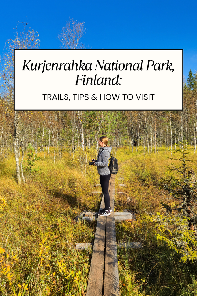
This is one of those places I keep coming back to, and no matter how many times I hike the exact same route, it never gets boring. And I mean, never. I visited this last autumn and again this autumn and honestly, I could go back right away.
My favorite route here is the Savojärvi Trail, which takes you around Savojärvi Lake.
In this post, I’m sharing all my tips for hiking this route, so if you love spending time in nature when visiting Finland, keep reading!
In a rush? My 3 favorite hotels in Turku with easy access to Kurjenrahka:
🏨 Hotel Kakola — Click here for rates & availability
🏨 Scandic Hamburger Börs — Click here for rates & availability
🏨 Solo Sokos Hotel Turun Seurahuone — Click here for rates & availability
| Location | Southwest Finland, Kuhankuonontie 67, Pöytyä |
| Distance from Turku | Around 35–40 minutes by car |
| Best for | Several marked trails, from short nature walks to longer hikes |
| Hiking trails | Savojärvi Trail |
| Popular trail | Savojärvi Trail, around 6 km |
| Best for a visit | A day trip from Turku |
| Facilities | Rest areas, lean-to shelters, campfire sites, toilets and designated camping areas. |
| Campfire site | The Kurjenpesä cooking shelter near the starting point |
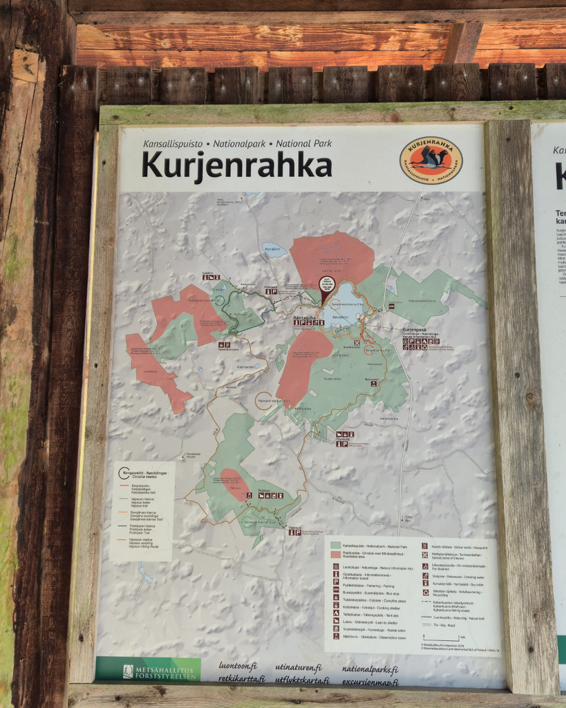
Where is Kurjenrahka National Park?
Kurjenrahka National Park is located in Southwest Finland, just outside Turku. This makes it a great day trip destination if you’re staying in the city and want to spend some time in nature.
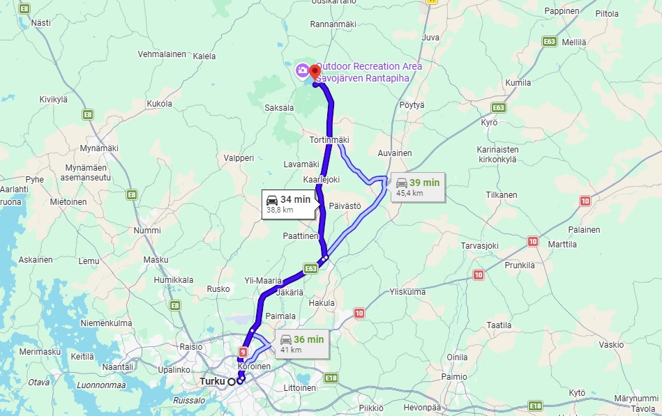
It takes around 35–40 minutes to drive from Turku city center to the national park, so you can easily leave the city behind for a while and enjoy a completely different kind of day.
The park is known for its forests, wetlands, bogs and lakes, offering a different kind of scenery from what you might expect if you’re visiting Finland for the first time. It’s a lovely place to experience the Finnish outdoors without having to travel all the way to northern Finland.
Also read: my ultimate summer guide to Turku!
How to get to Kurjenrahka National Park
Getting to Kurjenrahka is actually super easy.
You might think that nature is far away, especially when it comes to national parks. Maybe you need to rent a car and spend days planning how to get there and explore the area. But Kurjenrahka isn’t one of those places.
It’s only about 40 minutes from Turku city center, and you can get there either by car or public transport.
This makes it a great option if you’re staying in Turku and want to spend a day out in nature without having to travel far. You don’t need to plan a whole weekend around it, either. You can head out in the morning, spend a few hours hiking, and be back in Turku later that day.
And if you’re wondering which option works best for you, here’s how to get there.
Getting to Kurjenrahka by car
If you decide to drive here or you’re renting a car for your Finland trip, getting to Kurjenrahka is pretty easy.
The drive from Turku city center takes around 40 minutes, and the route is fairly straightforward. You can follow the directions on Google Maps to the parking area closest to the trail you want to hike.
Where to park:
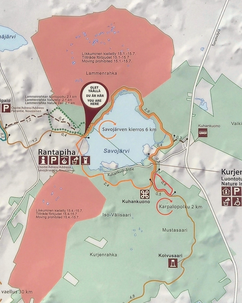
Kurjenrahka has several parking areas, so it’s important to choose the right one for your hike. If you’re planning to hike the Savojärvi Trail, which I’m covering in this post, make sure you head to the parking area that serves as the starting point for this route.
The first time I visited, I parked in the wrong parking area. And because my sense of direction is famously terrible, I didn’t realize I’d taken the wrong route back after finishing the hike.
Which meant that after a tiring hike, I still had to find my car and walk an extra couple of miles to get back to it. Not exactly how I wanted to end the day!
On the map, you can see that I’ve marked the parking area where I parked by mistake. It’s the first one you’ll come across when driving in, but if you’re planning to hike the Savojärvi Trail, continue further along the road to the next parking area. That’s the one you want, as it’s where the trail starts.
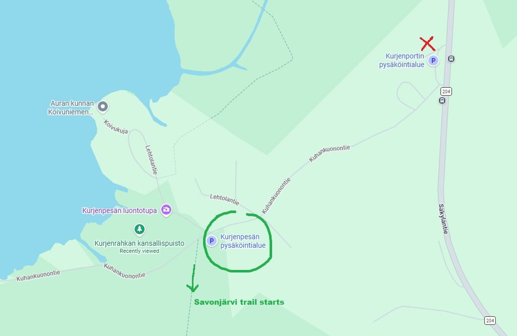
But, I learned from that first hiking experience here, and now I know where to go. So, double-check your parking spot before you start hiking, especially if there are several parking areas nearby.
If you’re planning a road trip around Finland, having a rental car gives you a lot more flexibility to explore places like Kurjenrahka along the way. And if you’re staying in Turku, you can also rent a car here for a day trip to the national park.
If you need a rental car for your trip, you can compare rental car options here.
Getting to Kurjenrahka by bus
If you don’t have a car, don’t worry! You can also get to Kurjenrahka by public transport from Turku, which is great if you’re visiting Finland without renting a car.
Föli operates bus services from Turku to Kuhankuono, right by the entrance to the national park. The journey takes around an hour, so it’s a little longer than driving, but you can still easily make it a day trip.
The bus departs from the Market Square area in Turku, and the stop you want is called Kurjenrahkan kansallispuisto (Kuhankuono). Just make sure you choose a departure that actually goes all the way to the national park, as not every bus on the route does.
Before you head out, check the timetable for your travel date and plan your return journey, too. You don’t want to finish your hike only to discover you’ve got a long wait for the next bus!
🚌 You can find the current routes and timetables on the official Föli website.
Best hiking trails in Kurjenrahka National Park
Kurjenrahka National Park has several hiking trails to choose from, so there’s more to explore than just one route. Whether you want a shorter walk in nature or a longer hike through the forests and wetlands, you have a few different options.
I haven’t hiked all the trails here myself yet, so I can’t give you my personal opinion on every route. But I can share my favorite so far, the Savojärvi Trail, and what makes it worth visiting.
Savojärvi Trail
Like I already mentioned, my favorite trail in Kurjenrahka so far is the Savojärvi Trail. And the reason I’m saying so far is that I haven’t hiked all the trails here yet, so my opinion might change at some point. Who knows? Although, honestly, I doubt it.
The Savojärvi Trail is just so gorgeous that it’s hard for me to believe there’s a prettier one here. And as someone who loves being by the water more than anything, that’s one of the reasons I love this hike so much.
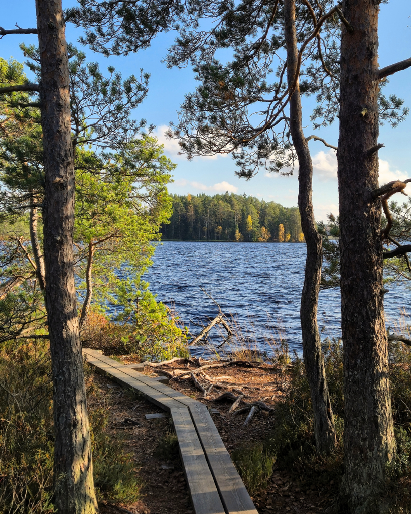
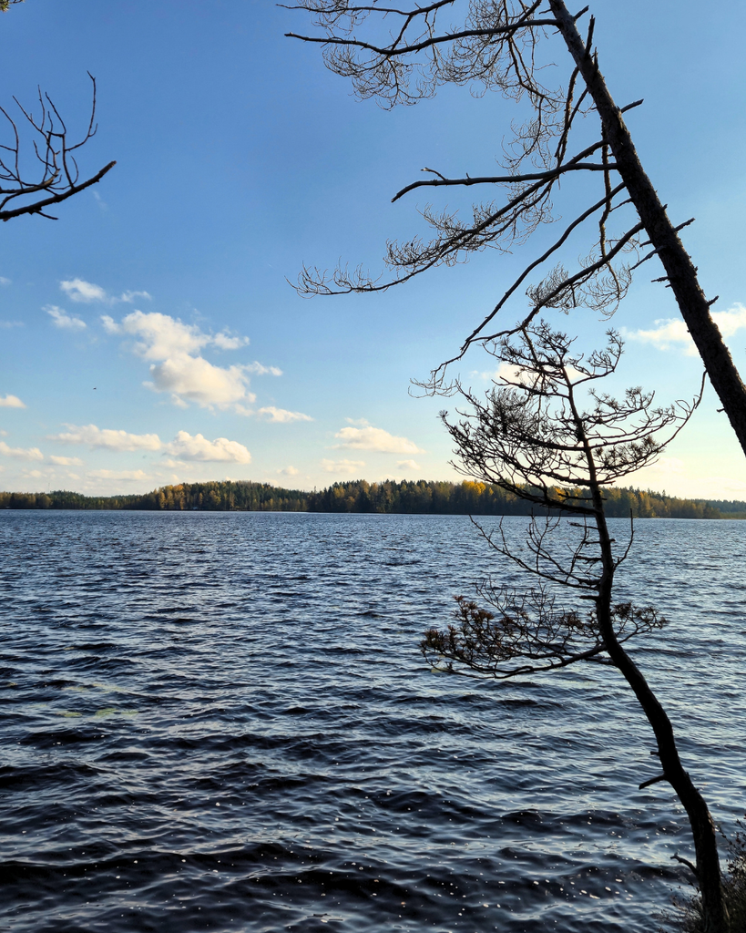
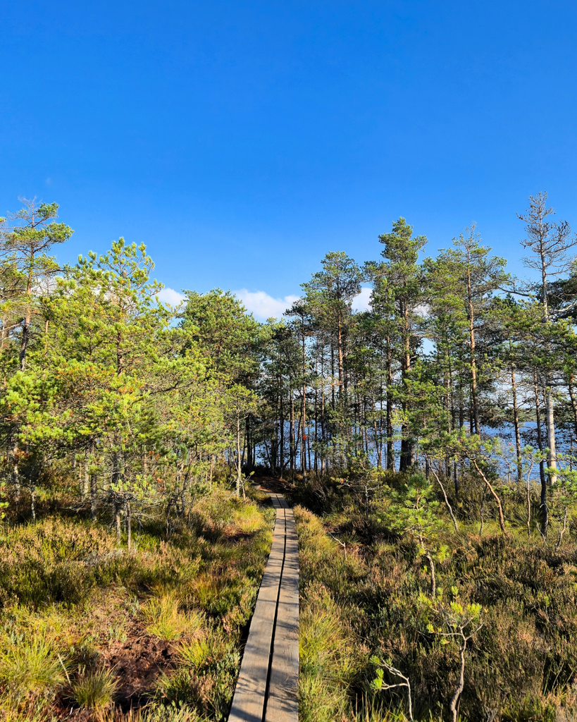
The trail takes you around Savojärvi Lake, and you get to walk right alongside the water for much of the journey. The views are beautiful, and I honestly never get tired of them.
🌳 The trail is marked with red markings on trees, so keep an eye out for those as you hike to make sure you’re following the right route.
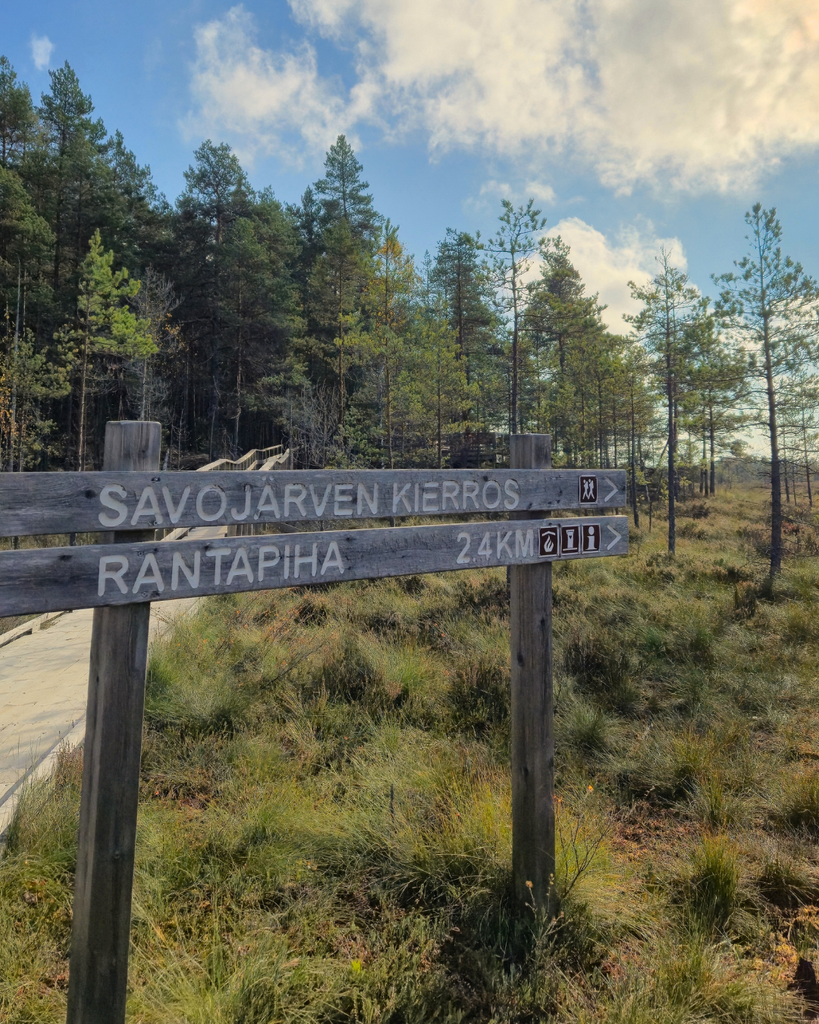
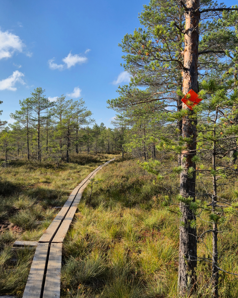
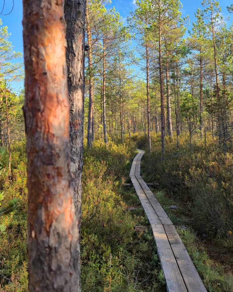
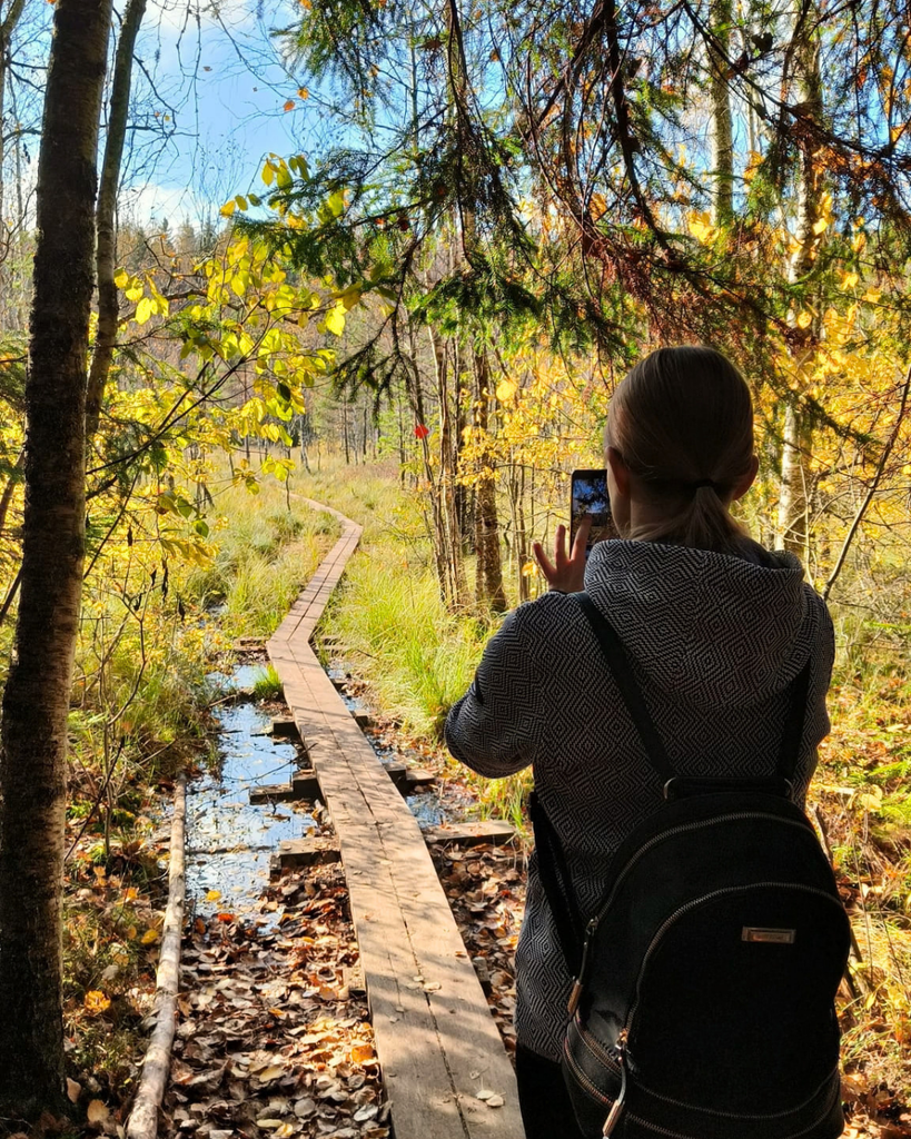
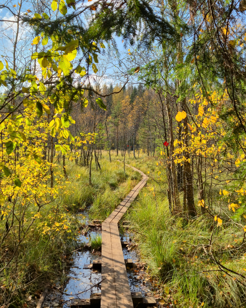
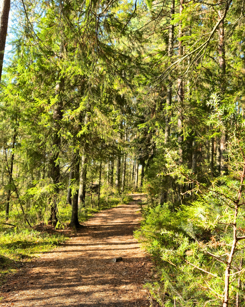
What I also love about this hike is that it never gets boring. You don’t spend the entire time walking through the same kind of landscape. Instead, the scenery changes as you go, from forest paths to wetlands and long wooden boardwalks.
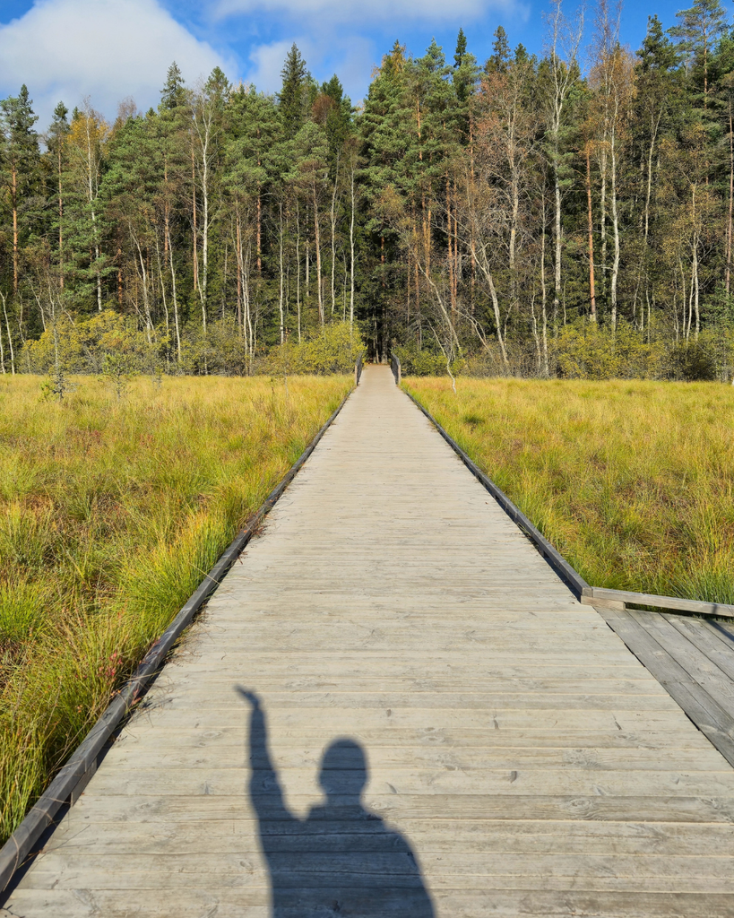
And those boardwalks! Some of them seem to stretch for miles, taking you through the wetlands and giving you a completely different view of the surrounding landscape. I always love these kinds of sections on a hike, and they’re definitely one of the highlights of this trail.
Another thing I love about this route is that I never feel the need to rush through it. I usually stop every now and then to admire the views, take photos, and just enjoy being there. So even though the hike is around 6 km long, I like to give myself plenty of time to do it.
Quick trail overview
| Distance | Approximately 6 km |
| Route | Circular trail around Savojärvi Lake |
| Estimated time | Around 2 hours, depending on pace and stops |
| Scenery | Forests, lake views, wetlands and boardwalks |
| Difficulty | Check the current official trail description before publishing |
| Starting point | Savojärvi parking area / trailhead — verify the exact name |
One tip I have for this trail: if you’re planning to stop for a snack or water break, I’d wait until you reach the lake.
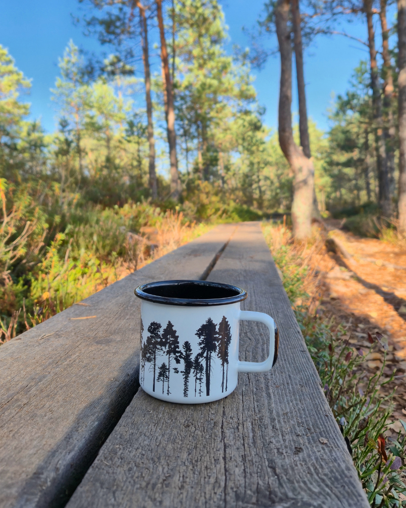
You’ll find a few places to sit along the way, although there aren’t that many. If it’s not too busy, you can also sit on the wooden boardwalk for a little break.
The views by the lake are absolutely gorgeous, and honestly, it’s the perfect spot to sit down, have a snack, and enjoy the scenery for a while.
Things to see along the Savojärvi Trail
Besides the lake views, forests and endless boardwalks, there are a couple of interesting things to look out for when visiting Kurjenrahka National Park. And if you enjoy learning a little about the places you visit, these are worth checking out before you head out on your hike.
The Crane Statue (Kurki)
Have you ever wondered where the name Kurjenrahka comes from? The Finnish word kurki means crane, while rahka refers to a type of bog. So, the name gives you a pretty good idea of the kind of landscape you’ll find here!
Kurjenrahka is an important habitat for many bird species, including cranes. The park’s wetlands and bogs provide suitable places for birds to nest and find food, making the crane a fitting symbol for the area.
At the beginning of the Savojärvi Trail, near the Kurjenpesä nature information hut, you’ll find a crane statue that pays tribute to these birds and the natural environment that makes Kurjenrahka so special. It’s a fun little detail to look out for when you arrive, especially if you haven’t thought much about the meaning behind the park’s name before.
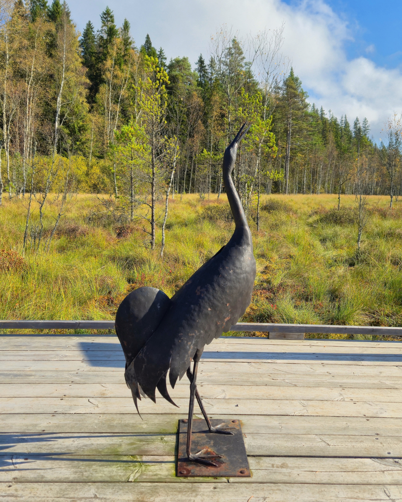
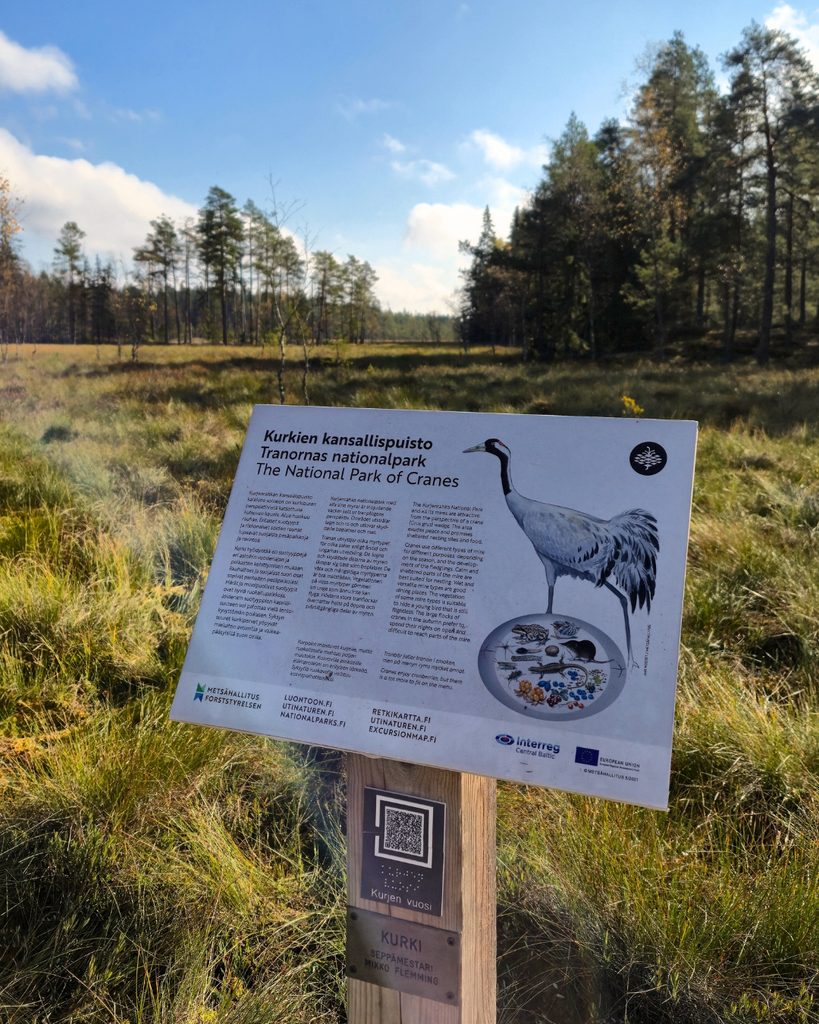
And even if you’re not particularly interested in birds, it’s a nice reminder that there’s more to this national park than just the hiking trails. The bogs and wetlands are an important part of the local landscape and the wildlife that lives here.
The Seven Municipalities Boundary Stone
After the crane statue, you’ll come across another interesting sight near the beginning of the trail, the historic boundary stone where seven municipalities meet: Turku, Aura, Rusko, Masku, Mynämäki, Nousiainen and Pöytyä.
The stone has a long history, with references to Kuhankuono dating back to 1381. Historically, it marked the boundaries between local administrative areas, and it remains a shared boundary point for the seven municipalities today.
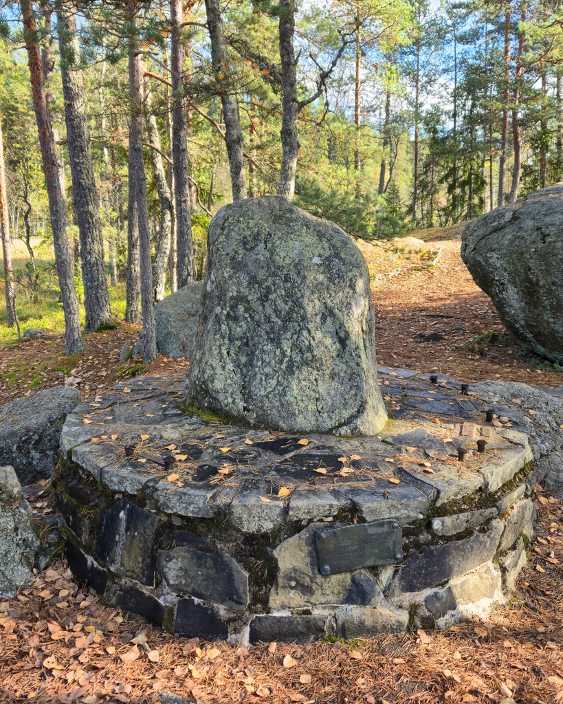
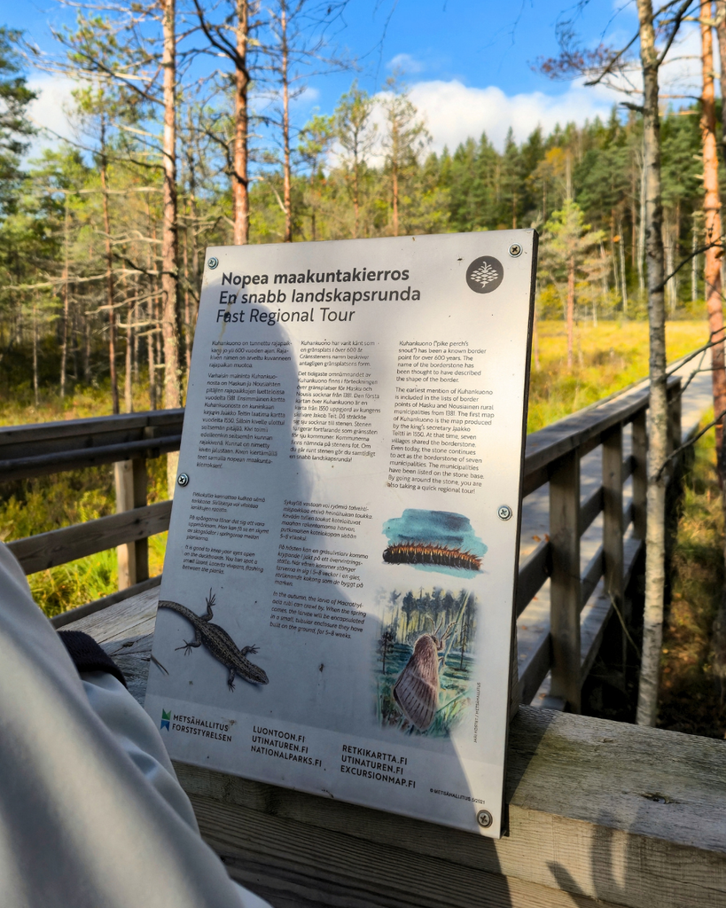
I think it’s pretty cool that you can visit a place where the boundaries of seven different municipalities meet, right in the middle of this beautiful natural area. It’s also a reminder that Kurjenrahka isn’t just a place for hiking; the area has a long history, too.
Other trails worth considering
The Savojärvi Trail is my personal favorite so far, but it’s not the only route worth exploring in Kurjenrahka National Park. I haven’t hiked all the trails here myself yet, so I can’t give you my personal review of these just yet. However, if you’re looking for a different kind of scenery, here are two other options to look into.
Pukkipalo Trail
If you love forests, the Pukkipalo Trail is worth considering. This route takes you through the Pukkipalo old-growth forest, with rocky sections and a different kind of landscape from the lakeside scenery on the Savojärvi Trail.
- Distance: Around 5 km from the Pukkipalo parking area, or around 9 km if starting from Rantapiha
- Estimated time: Allow over 3 hours for the longer route at a relaxed pace
- Difficulty: Moderate
- Starting point: Pukkipalo parking area or Rantapiha
Vajosuon Loop
For something different, consider the Vajosuon Loop. This route is a good option if you’d like to experience the park’s bog landscapes rather than spending most of your hike beside a lake. Vajosuo is known for its open mire scenery and a nature tower with views over the surrounding landscape
- Distance: Around 3 km
- Estimated time: Approximately 1 hour
- Difficulty: Generally considered an easier walk
- Starting point: Vajosuon parking area
When is the best time to visit Kurjenrahka?
One of the things I love about hiking in Finland is that the scenery changes so much throughout the year. Kurjenrahka is no exception, and each season offers a slightly different experience.
However, the best time to visit also depends on what kind of hiking experience you’re looking for. Trail conditions can change with the weather and the season, so it’s always worth checking the latest information before heading out.
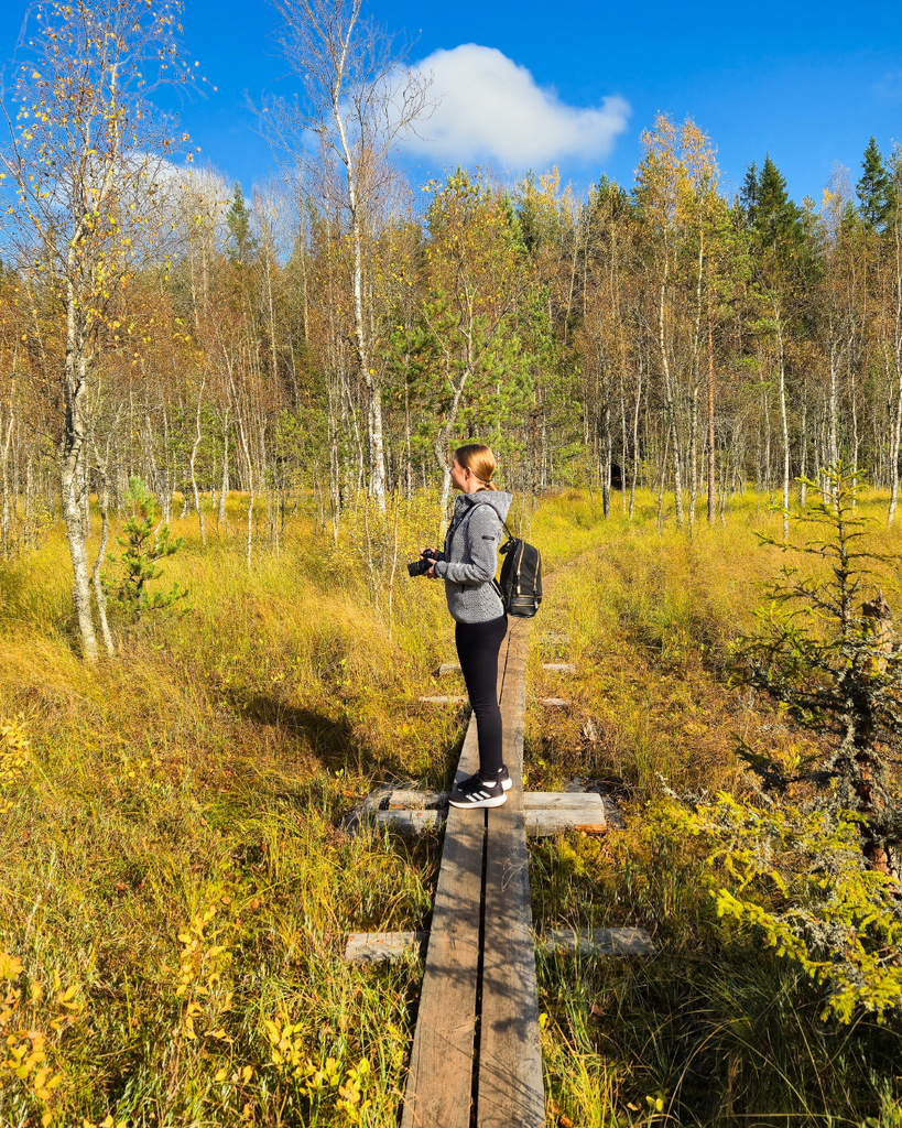
Spring
Spring is a lovely time to get back outdoors after winter, but it’s also when trail conditions can be a little unpredictable. Melting snow and rainy weather can leave paths wet and muddy, and some sections of the boardwalks may be affected by high water levels. If you’re visiting in early spring, check the current trail conditions before you go and make sure you have shoes that can handle wet ground.
Summer
Summer is a great time to visit Kurjenrahka. The days are long, the forests are green, and you have plenty of daylight to enjoy the hike without rushing back before it gets dark. Just keep in mind that not every part of the trail offers shade. While you’ll walk through forest sections where you can escape the sun, the wooden boardwalks across the wetlands are exposed, with very little shade.
🥾 A summer hiking tip: Bring enough water, wear sunscreen and remember to reapply it during your hike. The open boardwalk sections can get hot on sunny days, and you’ll be glad you came prepared!
Summer is also a popular time for hiking, so you may encounter more people on the trail, especially on weekends and during holiday periods.
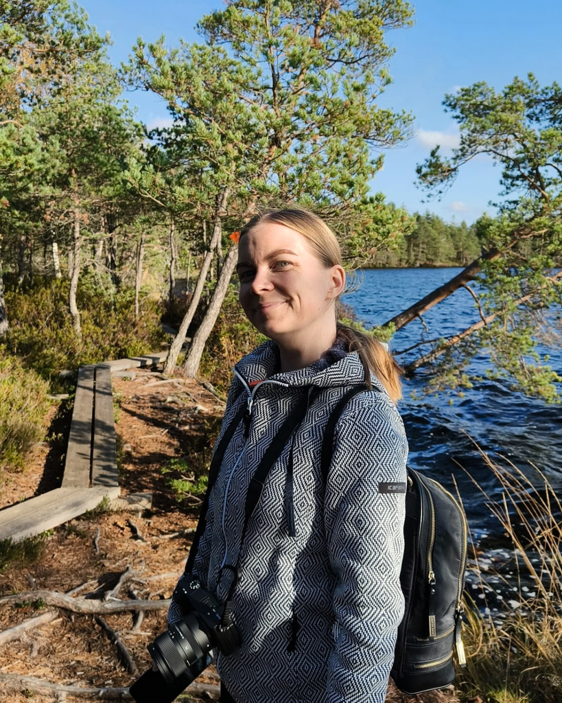
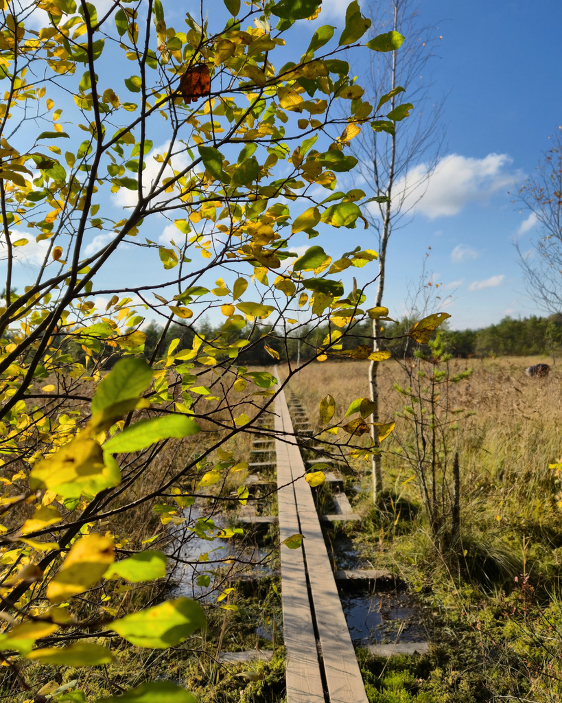
Autumn
Autumn brings a bit different atmosphere to Kurjenrahka and cooler temperatures that can make hiking more comfortable. It’s a lovely season for a walk if you enjoy crisp air and autumn scenery. Just be prepared for rain, muddy paths and shorter daylight hours as the season progresses. Waterproof shoes and a rain jacket can come in handy.
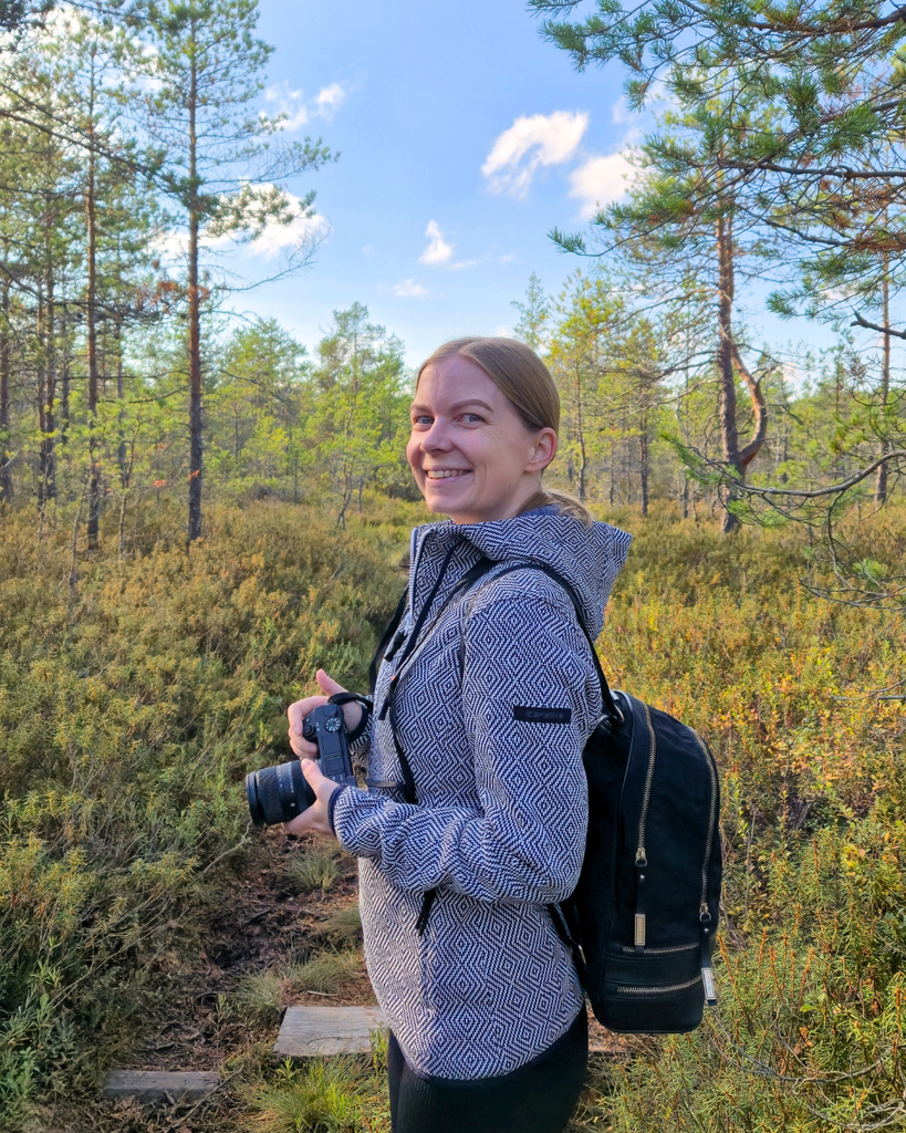
Autumn is actually my favorite time to hike here because it’s not too warm or too cold. I find the temperatures much more comfortable for hiking, and when I visited, I got by with just a light jacket.
One thing to keep in mind, though, is that if you’re coming to see beautiful autumn colours, Kurjenrahka might not be quite what you’re expecting. A lot of the forest is made up of evergreen spruce trees, so you won’t get those bright reds and oranges everywhere. The scenery is still beautiful, just in a different way!
Also read: Best time to visit Finland (locals guide to every season)
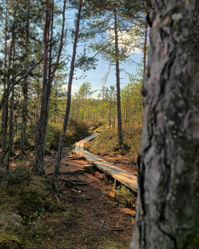
Winter
Winter can offer a completely different experience, especially when snow covers the forests and wetlands. However, conditions vary considerably from year to year, and snow isn’t guaranteed throughout the winter. Paths and boardwalks can be icy or slippery, so check the latest conditions before setting out and wear suitable footwear. Depending on the weather, some sections may be more difficult to navigate.
If you’re visiting during winter, plan your hike around the available daylight and give yourself enough time to finish before it gets dark.
💡 My advice: Whenever you decide to visit, check the current trail information and weather forecast before heading out. Conditions in a national park can change, and a little preparation makes your hike much more enjoyable.
Also read: What It’s Really Like to Visit Finland in October, November & December
What to pack for a hike in Kurjenrahka
Here’s one thing you should know about hiking in Finland: leave your brand-new white sneakers at home or at the hotel. Trust me, you can get them dirty in under five minutes!
Finland gets its fair share of rain, and the ground can be muddy and wet, especially after rainy periods. That’s why having the right shoes makes such a difference. You don’t necessarily need expensive hiking boots, but you do want something comfortable with a good grip that you don’t mind getting dirty.
Here’s a quick list of what I’d take with me to Kurjenrahka:
Practical tips before you visit
Before heading to Kurjenrahka, there are a few things worth knowing to make your visit easier.
- Check your route and starting point. Kurjenrahka has several trails and parking areas, so make sure you’re heading to the right starting point for the hike you want to do.
- Check the weather and trail conditions. This is especially important after heavy rain. Water levels can rise, and some of the wooden boardwalks may be underwater. Check the weather forecast on a Finnish website like Foreca, and look up the latest trail information before setting off rather than assuming the route will be in the same condition as the last time you visited.
- Allow extra time if the trail is wet. Muddy paths and wet boardwalks can make walking slower, so don’t plan your hike too tightly.
- Check public transport schedules. If you’re travelling without a car, make sure the bus goes all the way to the stop you need, and check your return journey before leaving Turku.
- Download your map before you go. I used Luontoon to follow the route, but it’s a good idea to have your route saved or available offline in case you lose your connection.
- Stay on marked trails. Kurjenrahka has sensitive bog environments and protected areas, so stick to the marked routes and check for any seasonal access restrictions.
- Check for temporary closures. Before your trip, check the official Luontoon website for information about Kurjenrahka National Park, including trail updates and any temporary closures.
- Bring a rubbish bag. There aren’t rubbish bins throughout the park, so take your rubbish home with you. The park’s main waste collection point is in the Kurjenpesä area.
A few more things to know before you go
- Accessibility: The Savojärvi Trail is not a fully accessible trail. The uneven forest paths and wooden boardwalks mean it isn’t suitable for wheelchair users throughout the route. I’d verify the current official accessibility information before making a definitive claim.
- Dogs are welcome, but keep them on a leash. A useful reminder for visitors hiking with their dogs.
- You might find wild berries. If you’re visiting in late summer or early autumn, keep an eye out for wild blueberries and lingonberries along the trail. When I visited in early October, I saw a few people picking berries, so it’s definitely possible to find some even then!
- Only make fires at designated campfire sites. There’s a rest area roughly halfway along the Savojärvi Trail with covered barbecue shelters, making it a nice place to stop for a break and something to eat. Just remember to check whether fires are allowed before lighting one, as fire bans can apply during dry conditions.
Final thoughts on Kurjenrahka
Can you now see why this place is one of my favorites? 😍
Kurjenrahka is definitely one of the easiest national parks to explore if you’re traveling around Southern Finland, especially if you’re staying in Turku. You don’t have to drive for hours or plan a whole weekend around it to enjoy some beautiful Finnish nature.
The Savojärvi Trail is one of those hikes I keep coming back to, and I honestly don’t think I’ll get tired of it anytime soon. Between the lake views, forest paths, and those long boardwalks through the wetlands, there’s always something to enjoy along the way.
So, if you’re visiting Turku and want to spend a few hours away from the city, I’d definitely recommend adding Kurjenrahka to your itinerary. Just remember to check the weather and trail conditions before you go!
And if you do visit, let me know what you think. I’d love to hear about your experience!
Explore more places around Turku:
- 6 best museums in Turku
- Turku archipelago: Nauvo & Seili day trip
- 5-Day Southwest Finland Itinerary: Turku, Naantali, Uusikaupunki & Rauma